
SAmpLE PROJECT
A Central SPot For all your Trail INformatION
This is an example of the comprehensive project page you’ll have access to through Advanced Trail Design. It serves as a central hub for all your essential design data, featuring presentation materials, detailed construction information, and cost estimates all conveniently compiled in one easy-to-navigate location.
Brief
This project aims to create a diverse, sustainable mountain bike trail network on a 200ha property, catering primarily to teenagers but offering options for riders of all levels.
Client: your name
Property Address: address
Property Size: 200ha
Elevation Change: 180m
Client Goals:
Create a fun and engaging trail network, utilizing the property's unique terrain and elevation change, while catering to teenagers and riders of all skill levels.
Prioritize sustainability to minimize maintenance requirements.
Incorporate the existing fire trail for potential shuttle runs.
Trail Specifications:
Total Trail Length: Up to 9.4 km
Trail Types:
Beginner (Green) Flow Trail: Easy, flowy, with gentle features and rollable obstacles. Enjoyable even for those intimidated by mountain biking.
Beginner (Green) Climb Trail: Moderate grade for easy ascent.
Intermediate (Blue) Downhill Trail: Moderate technical features, jumps, and berms.
Difficult (Black) Downhill Trail: Leverage the rugged terrain to create challenging, natural features for experienced riders.
Design Considerations:
Terrain: Steep terrain, soils with high shale and low clay content.
Trail Standards: Adhere to IMBA sustainability guidelines and Australian MTB Trail Rating guidelines.
3D Modeling: Develop interactive 3D models for each trail, accessible via a web browser, to aid visualization and construction. As an immersive experience, make one feature trail available in the Descenders video game.
Deliverables: Provide GPS traces for each trail and detailed construction cost and maintenance estimates.
Site ANALYSIS
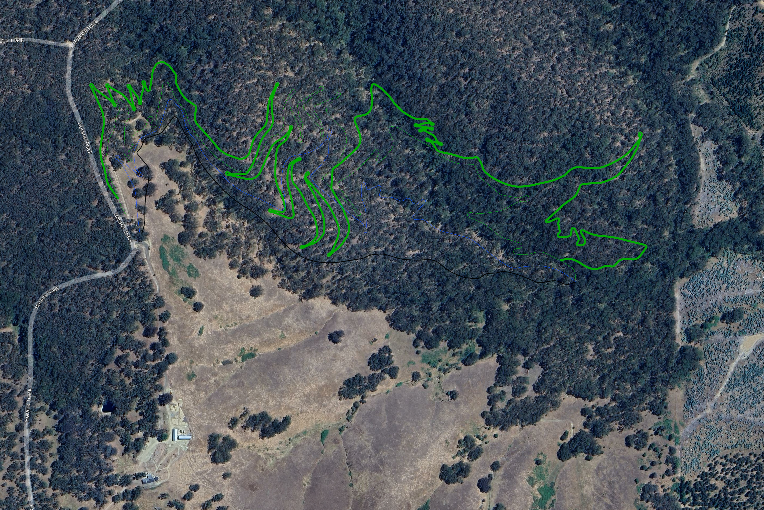
The property's terrain was analyzed using a high-resolution LiDAR ground model and GIS software to determine optimal locations for a mountain bike trail network. Areas suitable for trail types were determined based on side slope analysis, with results visually represented on a color-coded diagram. It also highlights the main watercourses. Satellite imagery was also incorporated to identify areas with dense tree cover, which are known to promote more sustainable trail environments.
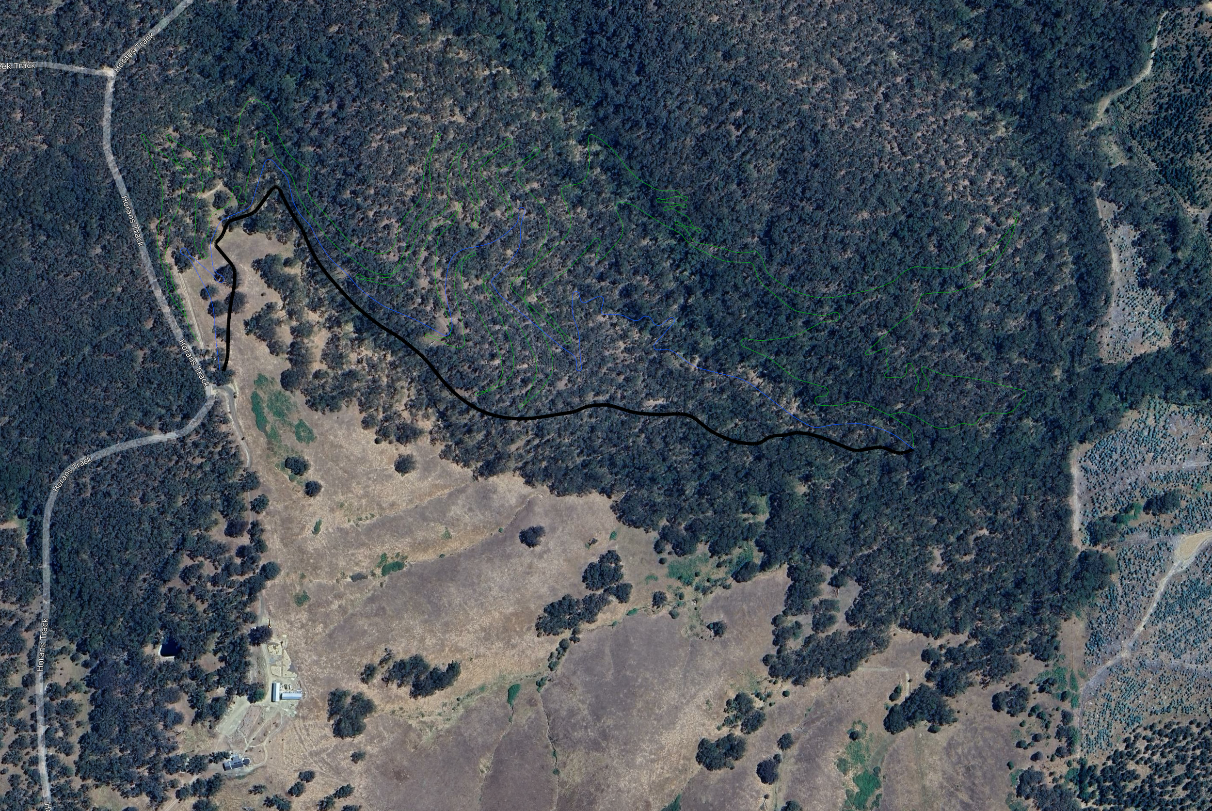
Based on the mapping, the entry point to the property was identified as the best spot for the launch pad, due to it being one of the highest points on the property and providing a suitable turnaround spot for a shuttle vehicle. The bottom of the gully, where the three gouges meet, is the best spot for the trail finish, as it's at the lowest point of the property, but still outside the flat terrain of the gully runout, which could become boggy. It also intersects the fire trail for shuttle pickups. As shown in the table below, this elevation drop can then be used to estimate the trail lengths working off their ideal average gradient.
LiDAR Source: source and date
Resolution: 50cm
Launch pad site: Property entry (455m)
Trail finish: Gouge meeting point (280m)
Elevation Difference: 175m
WATERSHED ANALYSIS
This analysis identifies major watercourses and potential flood zones to inform sustainable trail placement. It utilizes a LiDAR ground model, historical rainfall data, and runoff estimations to simulate water flow.
Data Sources:
LiDAR DEM: 50cm resolution
Rainfall: [Station Name] (Australian Government, Bureau of Meteorology)
Catchment Area: 544,800 m²
Max Probable Rain Intensity: 26mm/hr
Runoff Coefficient: 0.6
Estimated Flow Rate: 2.4 m³/s
Note: This analysis serves as a preliminary guide for sustainable trail placement. It's based on estimated rainfall and runoff data, which may not account for long-term cycles or climate change. Further research and risk assessment is needed for infrastructure design where safety is critical.
TRAIL NETWORK Overview
In line with the clients brief, and to make the best use of the terrain, five unique trails have been plotted to suit a wide range of skill levels. The table below provides an overview of the trails, along with estimated construction and maintenance requirements.

Green Descent
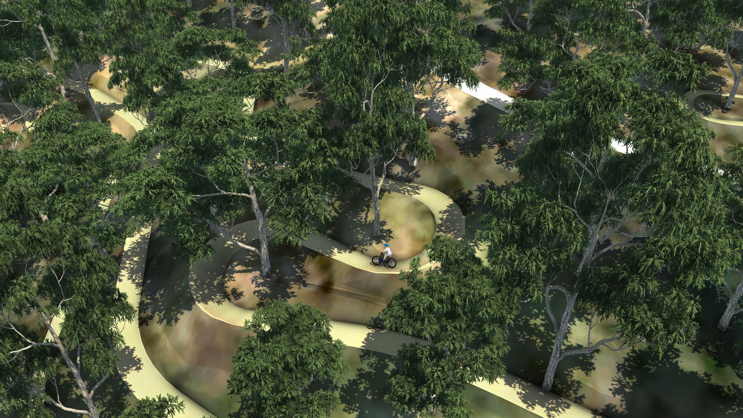
Starting from the highest point in the property and descending to the lowest, this 2.5km trail has an average downward gradient of 7%. This is the perfect steepness to allow less experienced riders to comfortably roll down, while more experienced riders can increase the challenge by pedaling more. All berms should be large and supporting, and jumps and rollers up to 1m high, shaped so that you can safely roll or get some good air with extra speed. Enjoyable for all levels of mountain bike riders.
Rating: Easy (green)
Length: 2540m
Width: 2m
Avg Gradient: 7%
Max Gradient: 15%
Est. Average Speed: 20km/hr
Est. Run Time: 7min

GPS TRACE
Green CLIMB
Starting from the downhill trail end and gradually climbing to the launch pad, this 4.3km trail offers an average upward gradient of 4%. The moderate incline not only makes the ascent easier but also provides a picturesque route back to the top in comparison to the fire trail.
Rating: Easy (green)
Length: 4375m
Width: 1m
Avg Gradient: 4%
Max Gradient: 10%
Est. Average Speed: 9km/hr
Est. Run Time: 30min
GPS TRACE
BLUE DESCENT
Starting from the launch pad and descending to the lowest point, this 1.6km trail has an average downward gradient of 11%, ensuring a thrilling descent for riders. The slope generates ample speed, ideal for clearing the trail's larger jumps. To enhance the rider experience, steep and supportive berms are recommended, along with jumps reaching heights of up to 1.5m.
Rating: Intermediate (blue)
Length: 1628m
Width: 2m
Avg. Gradient: 11%
Max Gradient: 20%
Est. Average Speed: 18km/hr
Est. Run Time: 5min
GPS TRACE

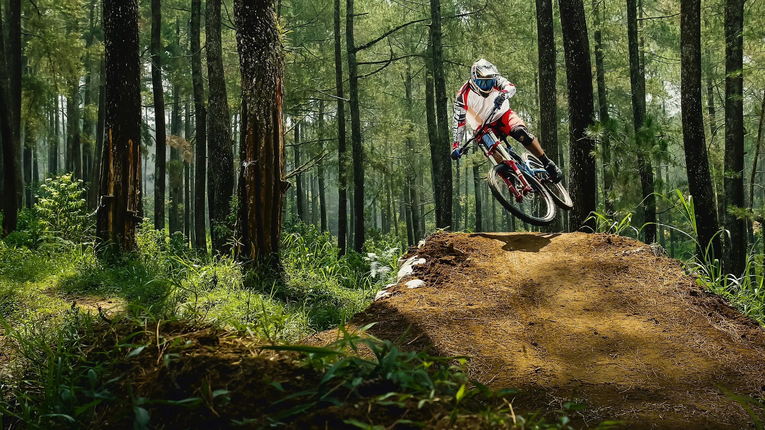
BLACK DESCENT
Starting from the launch pad and descending to the lowest point, this 1km trail has an average downward gradient of 17%, making best use of the property's elevation to deliver a steep challenge for expert riders. Leverage the rugged terrain to create challenging, natural features for experienced riders, enhancing the excitement and skill level required to conquer this thrilling trail.
Rating: Difficult (black)
Length:1044m
Width: 2m
Avg. Gradient: 17%
Max Gradient: 30%
Est. Average Speed: 20km/hr
Est. Run Time: 3min
GPS TRACE
Play
Your trail has been made available to experience through an interactive video game! Follow these instructions to get started:
Head to the Steam store online and purchase Descenders for PC https://store.steampowered.com/app/681280/Descenders/
Custom trails are currently only available on PC.
You also need a gamepad to play the game.
Once you’ve downloaded the game, try out the tutorials to get used to the controls.
When your ready to hit your trail, head to the mod store:
main menu > mods > open mod browser > search for Private Trail Design Demo by Advanced Trail Design.Wait until the new mods downloaded, then navigate to:
main menu > mods > Private Trail Design Demo

GPS INSTRUCTIONS
These detailed instructional videos are designed to provide you with step-by-step guidance on loading and effectively utilizing the GPS paths that have been provided for your device.
Trail Guidelines
The International Mountain Biking Association (IMBA) developed a set of guidelines for trail construction, which have been adapted by the Australian Mountain Bike Trail Guidelines. These guidelines were first published in 1993 and are considered the world-class standard for constructing natural surface trails, not just for mountain biking but for all trail use. The primary aim of these guidelines is to manage water flow on trails, thereby reducing erosion, maintaining trail quality, lowering maintenance costs, and protecting the surrounding environment.
The basic trail corridors, as supplied in GIS form, have been designed using these guidelines. It is also important for builders to follow these guidelines for the detailed finishing of the trail shape.
For full trail building, rating and safety guidelines, refer to the Australian Mountain Bike Trail Building Guidelines.
How to load gps path onto Garmin Device.
How to open trail path on Garmin device.
Using in the Field
GPS traces are supplied to guide the trail building process, ensuring that the trails are built at the appropriate gradient for their designated difficulty level and will reach key locations. Accurate ground modelling was obtained, allowing for precise plotting of the trail path.
Modifications may be made during the trail building process to avoid obstacles or incorporate features, provided you stay within approximately 7 meters of the trace.

If you’d like to take full advantage of these comprehensive services for your unique trail project, please do not hesitate to reach out to us for an obligation-free quote. We are here to assist you in bringing your vision to life.